After a peaceful night at The Rustler Motel and a fast breakfast at McD’s we headed south towards hwy 20. It is a 45 mile drive, all but 10 is paved. It does get interesting as you drive along the river, lots of USFS campgrounds through there. $8 a night or $4 with a senior pass. Soon, we reached the dam and after that the end of the road. Rain had started to fall and the mixture of clouds and smoke made for a dreary morning. We did see a herd of elk right along the road and four or five crossed the road in front of us. Too dark for a picture unfortunately. Most of our pictures didn’t come out.


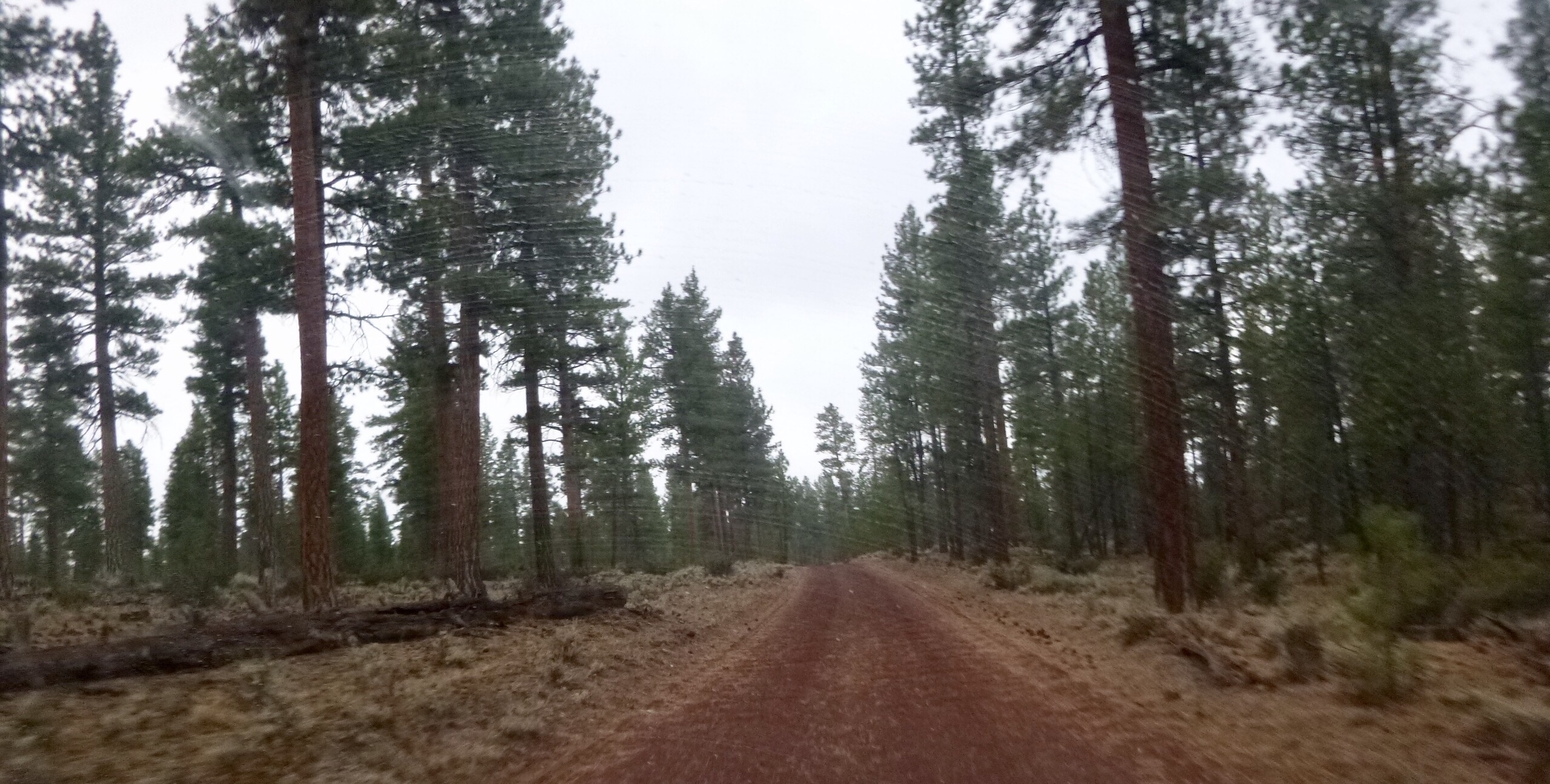
Once we made the zig zag at hwy 20 onto the next road we were headed up into the trees. The previous landscape was mostly scrub brush. I guess it is interesting to look at for about 15 minutes before it gets mind deadening. After arriving into the treed area, we were seeing huge Douglas Fir trees, excellent two track roads that were so soft you felt like you were driving on pillows. Shortly, we were in an area designated for OHV vehicles. It wasn’t restricted to them, but they were allowed on the roads in this area. It was a maze of roads and without a map, you’d surely be lost quickly. We managed to find our way through and were on our way to Newberry Monument.

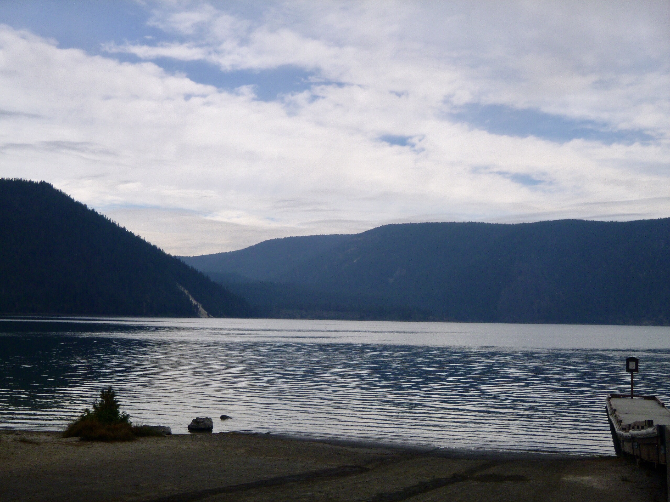
We had visited here last year while we were camped on in Cascade Lakes road. It was a holiday weekend but the weather was just not cooperating. Up in the Cascades, it was overcast and cool. Getting any solar charging done was futile and charging with the inverter was not working very well. We ended up leaving early. The Newberry Monument is a volcanic area with twin lakes formed from the cones of the volcanoes. We weren’t in there long and before we knew it we were in La Pine. Sams route has you making a convoluted trip through neighborhoods raising dust and making a nuisance of ourselves. Ultimately, we arrived at a sign stating that the road ahead was private. We turned around and went back out to 97. Just a couple miles south on 97 and you are on Masten Rd. This is the same road you will be on going after La Pine. This way was much easier. It is a bit of a haul down towards Crescent on a very dusty road with nothing to look at. As you proceed south be in the lookout for FS62. It is a paved road that intersects with Masten. Turn left at this point and avoid more private roads and huge no trespassing signs.


We arrived in Crescent, topped off the tank and went across the street to the Rangers Office. We wanted to check out the next section of trail going over Windigo Pass. The man at the desk said it was open. We showed him our next section after 138 and asked him if these roads were open. He said he checked all these roads yesterday for another TAT rider and they were open. With renewed optimism, we headed out thinking we wouldn’t need to divert around the forest fire. We went up and over Windigo Pass with no issues. The drive up was fine, but the road going down was washboard and hard to drive on.
We reached 138 and proceeded into the woods. There were no signs indicating the roads were closed. That is, until we reached the end of the first section. There was a road block there, but it was pulled over to the side. We decided to proceed and were making good time on great roads and no sign of any burns or fire fighters anywhere. As we rolled up to the intersection with hwy 28 we thought we were going to be able to get through. The intersections was clogged with fire trucks and fire fighters. We were checking our map to see which way to turn. That road was blocked by a fire truck. One of the fire fighters came over to check on us. He was curious why we were there and where we were trying to go. We told him about what we were told at the Rangers Office. He said that the roads may be open but were still dangerous as there were trees still falling across the roads and they were cleaning up the area with controlled burns. He suggested we take 28 north to 138 and go west from there. So, we decided to do that. It was scary as we were driving through areas still burning and there were trees down everywhere. We had seven miles to go. Fortunately, we made it to the road and we had to wait there for a westbound escort truck. Soon, we saw one and joined the line of cars going west.

We decided to head to I5 and take that south to Canyonville where we are tonight. Tomorrow we head for the coast!
Leave a Reply